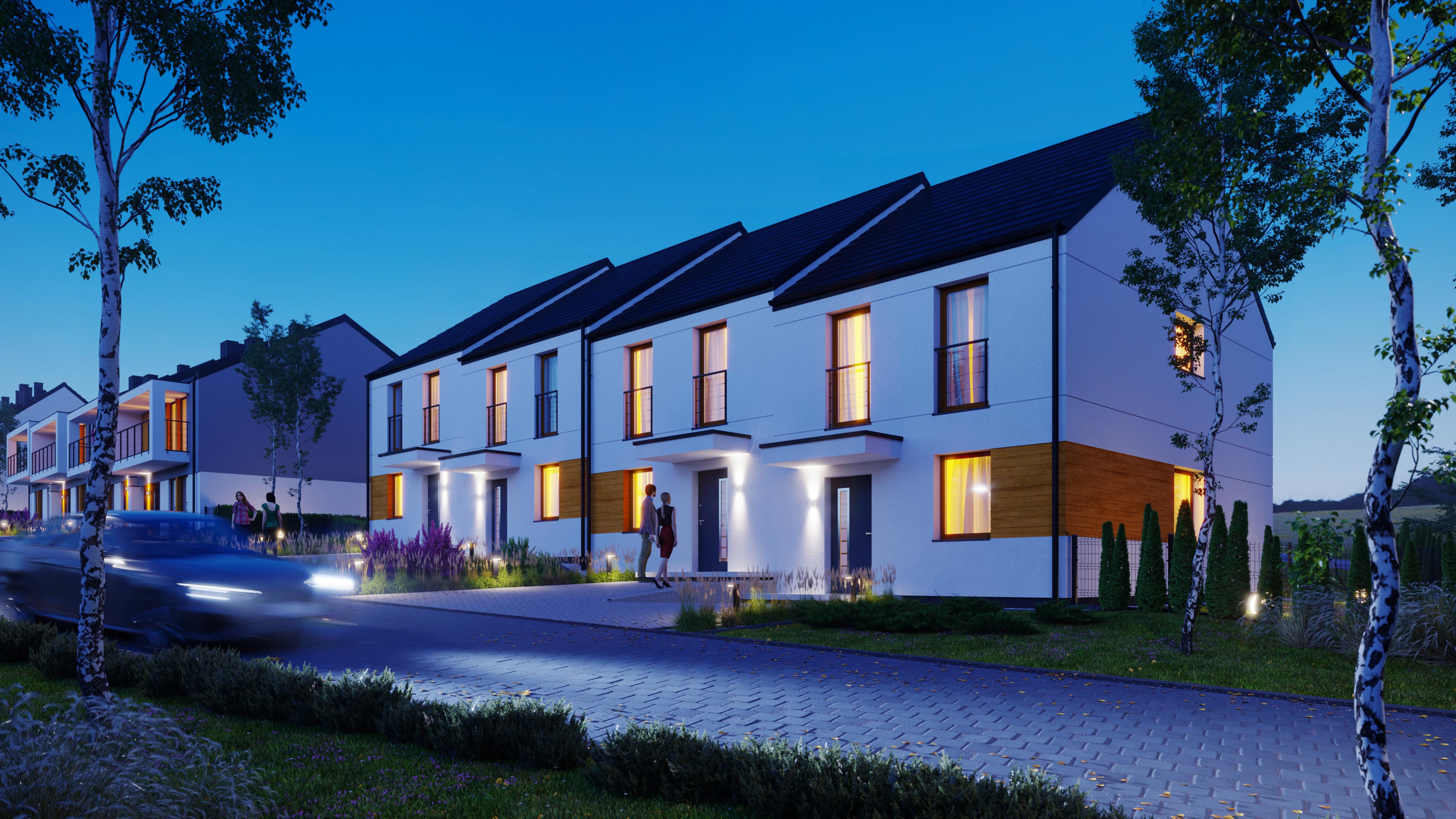
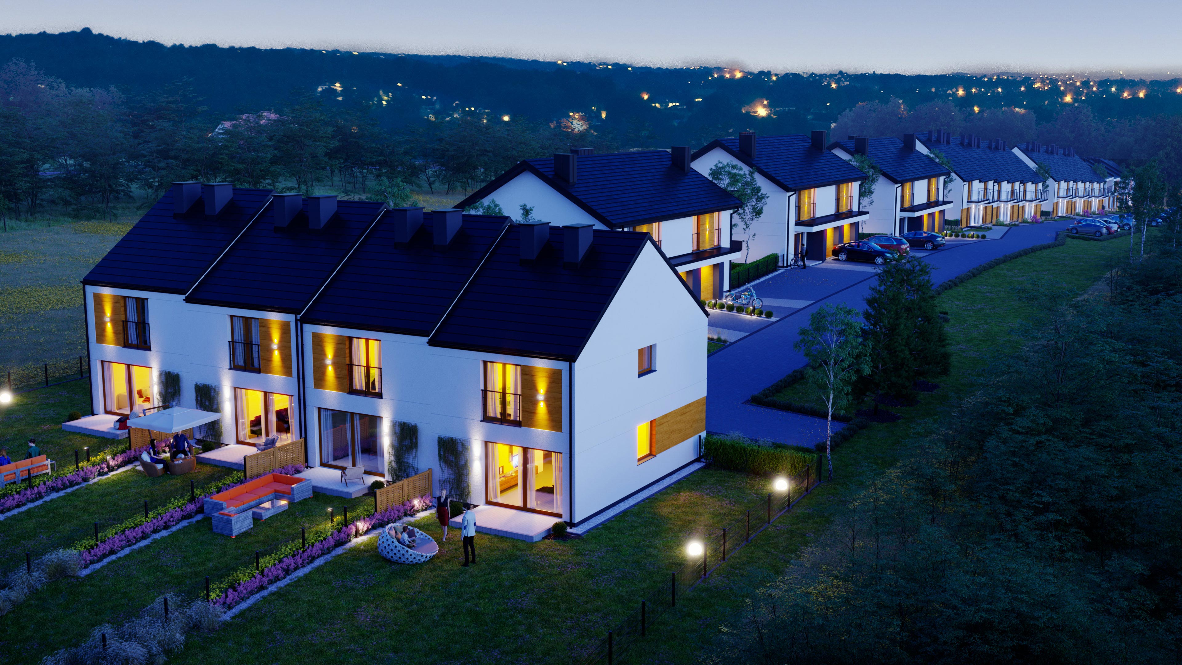
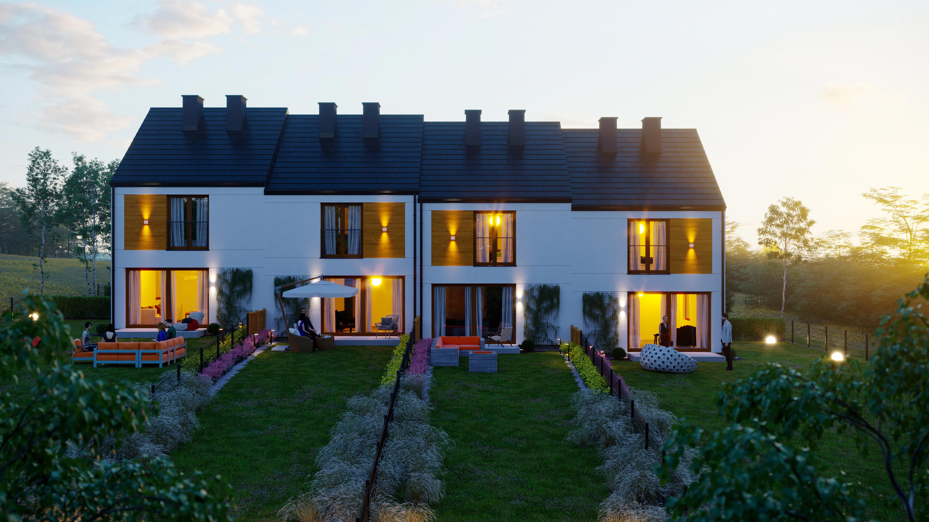
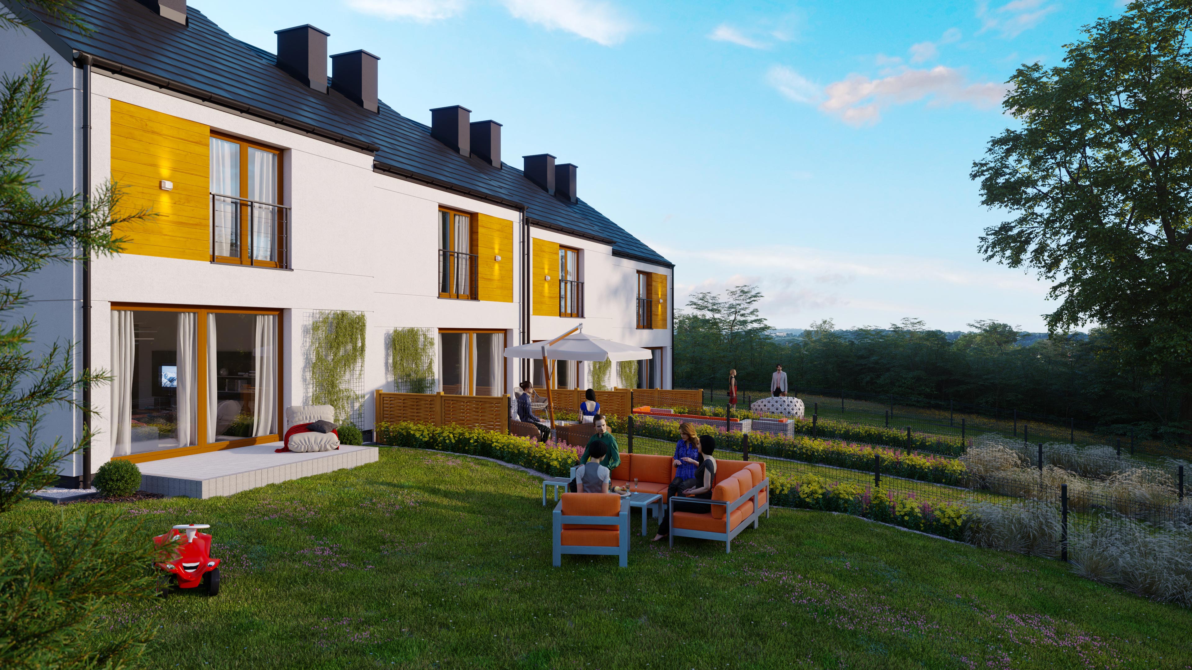
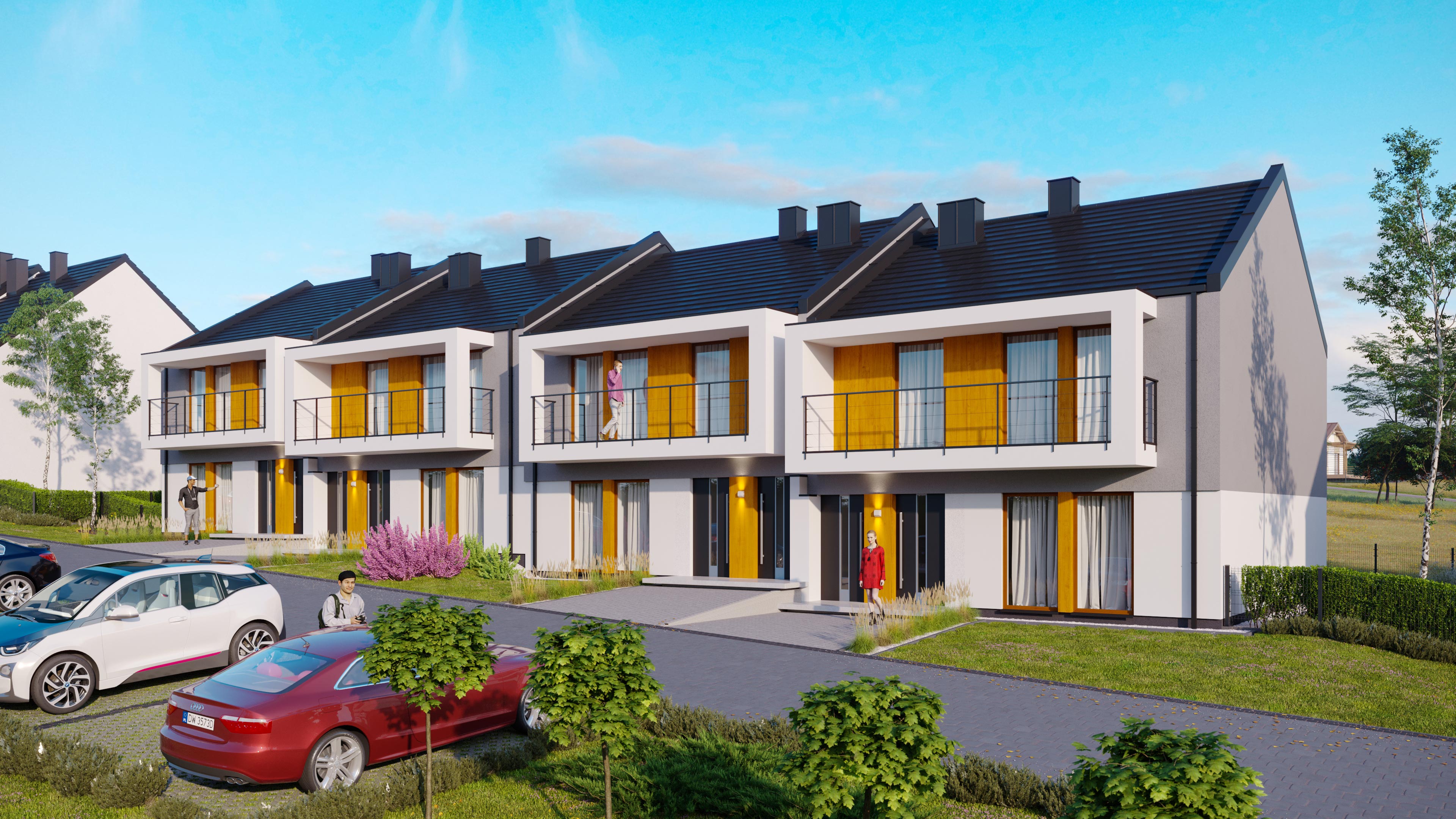
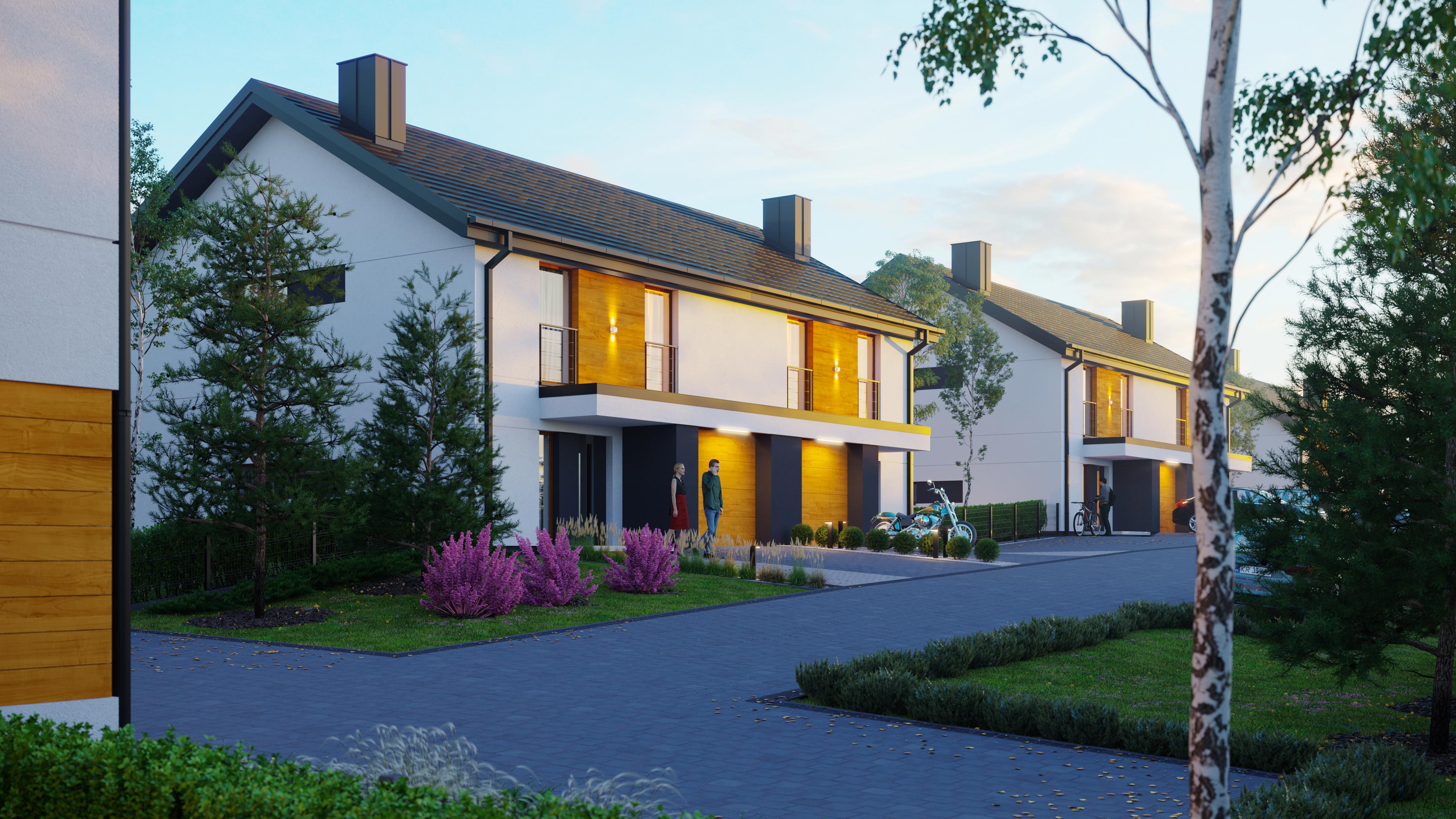
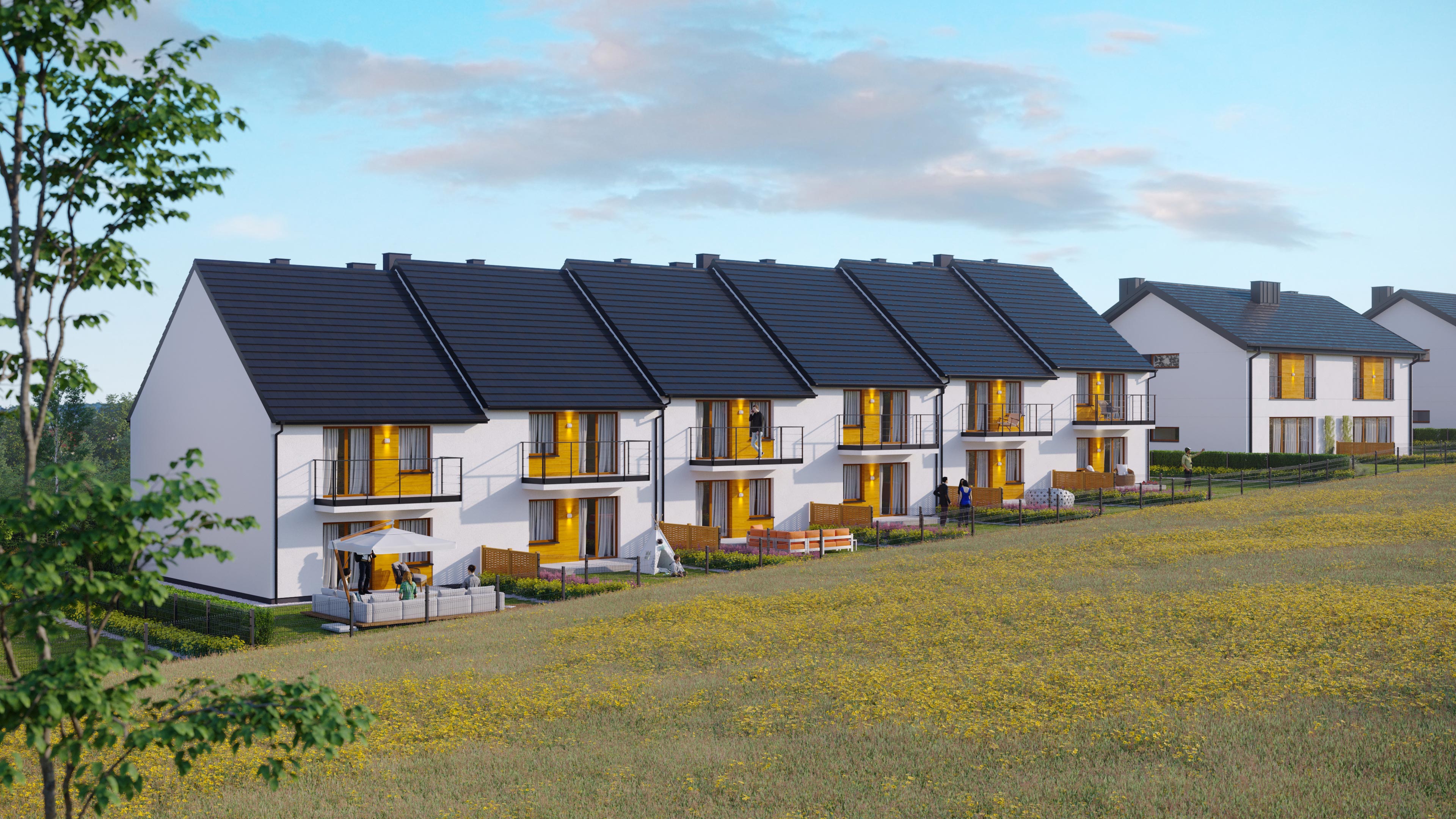
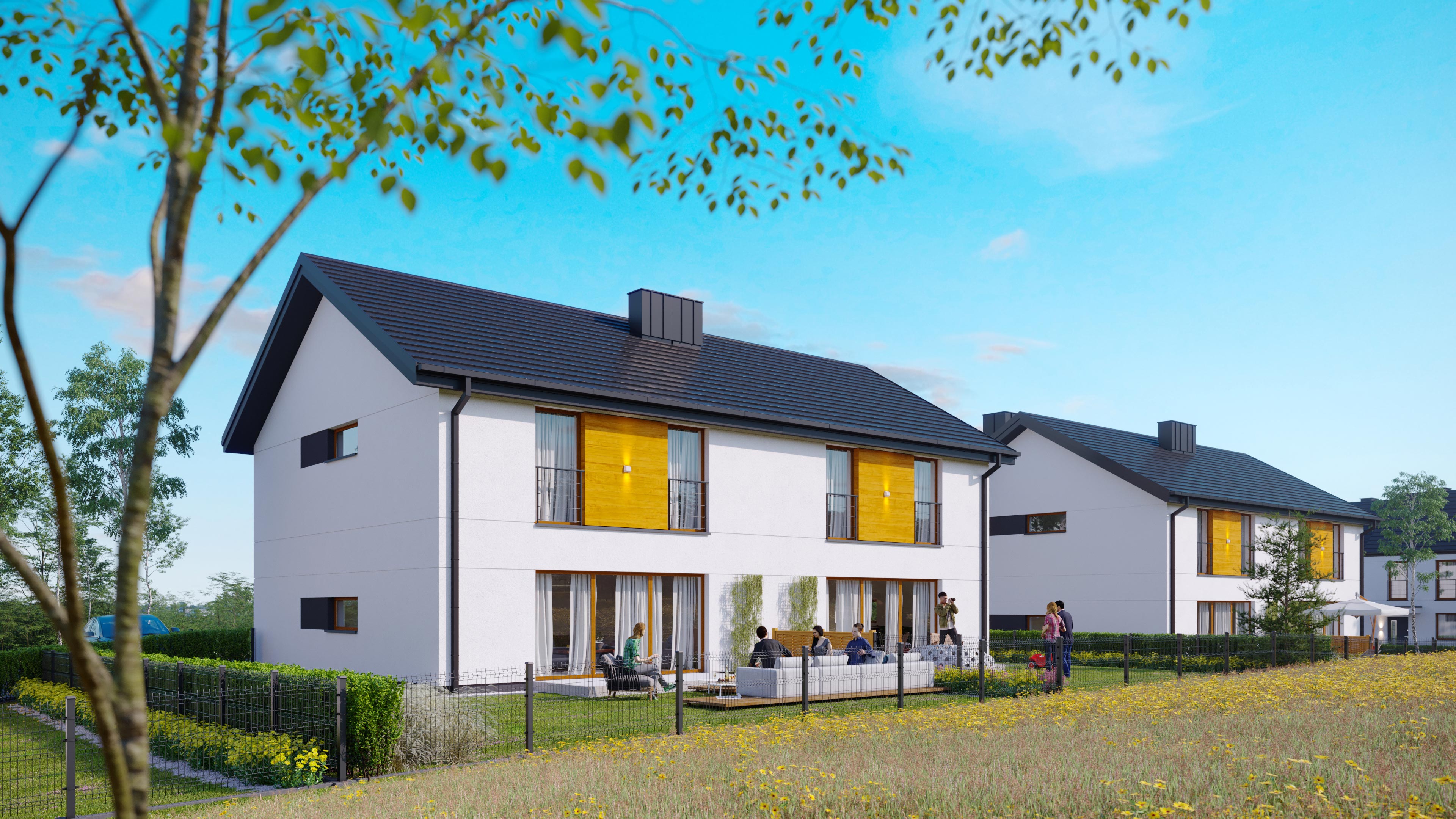
3D CGI ARCHVIZ of MAGNOLIA RESIDENCES

The Goal

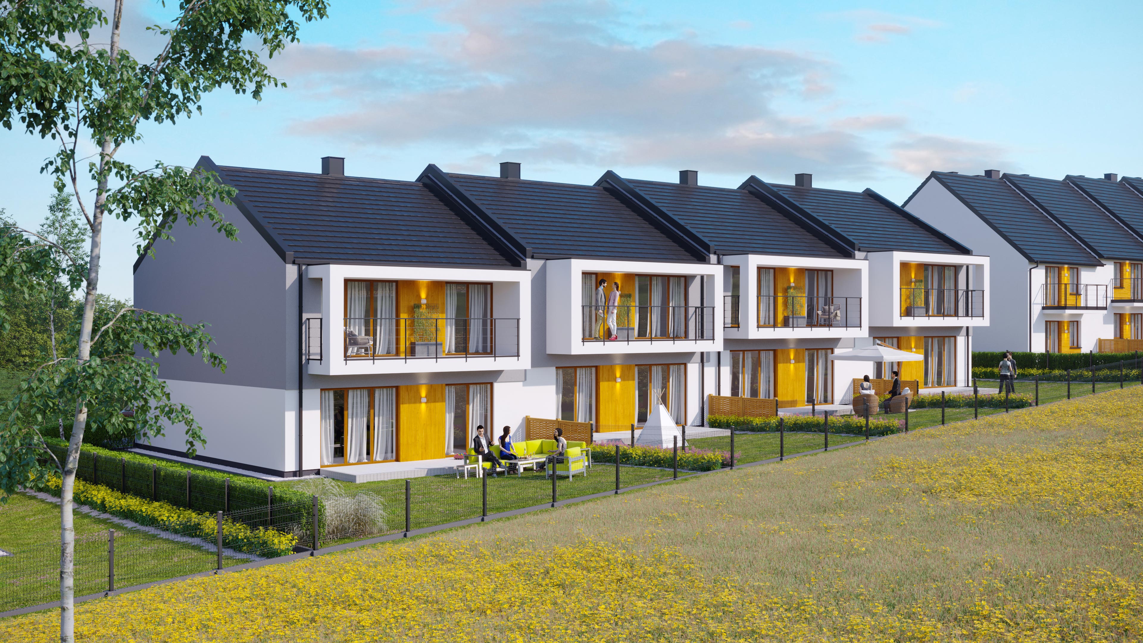
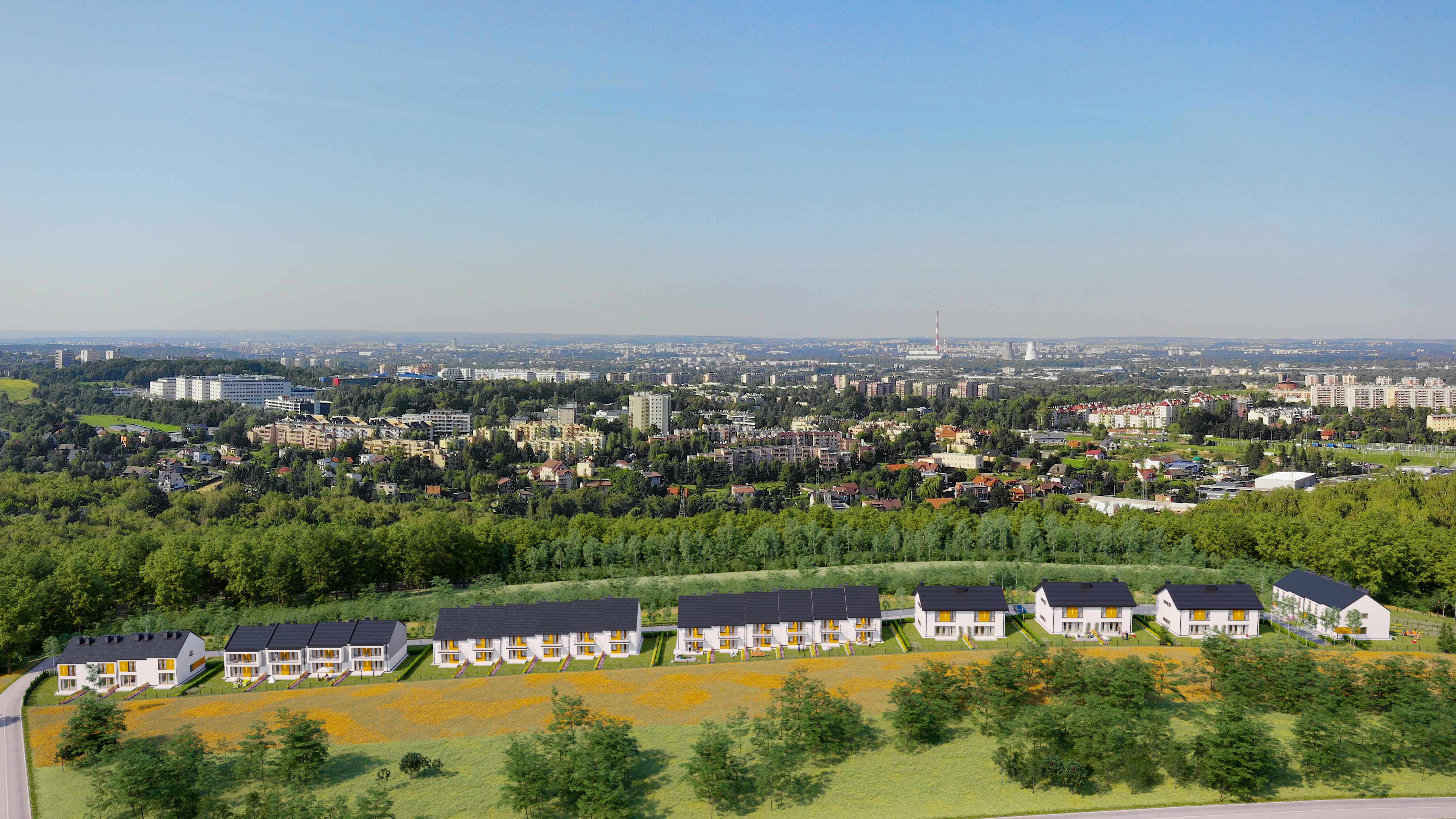
The primary commercial objective of this multi-family residential architectural visualization project was to maximize off-plan sales velocity and validate the premium valuation of Magnolia Residences. When marketing residential units whose primary selling point is a suburban location with a clear view of the Kraków skyline, flat blueprints fail to convey the geographical advantage. The studio was tasked with creating high-resolution exterior architectural renders that accurately position the buildings within the real-world topography. The core business purpose was to provide the property developer with a high-performance visual asset portfolio that converts speculative leads into binding reservation agreements long before the foundation stone is laid.

Technical CGI Engineering

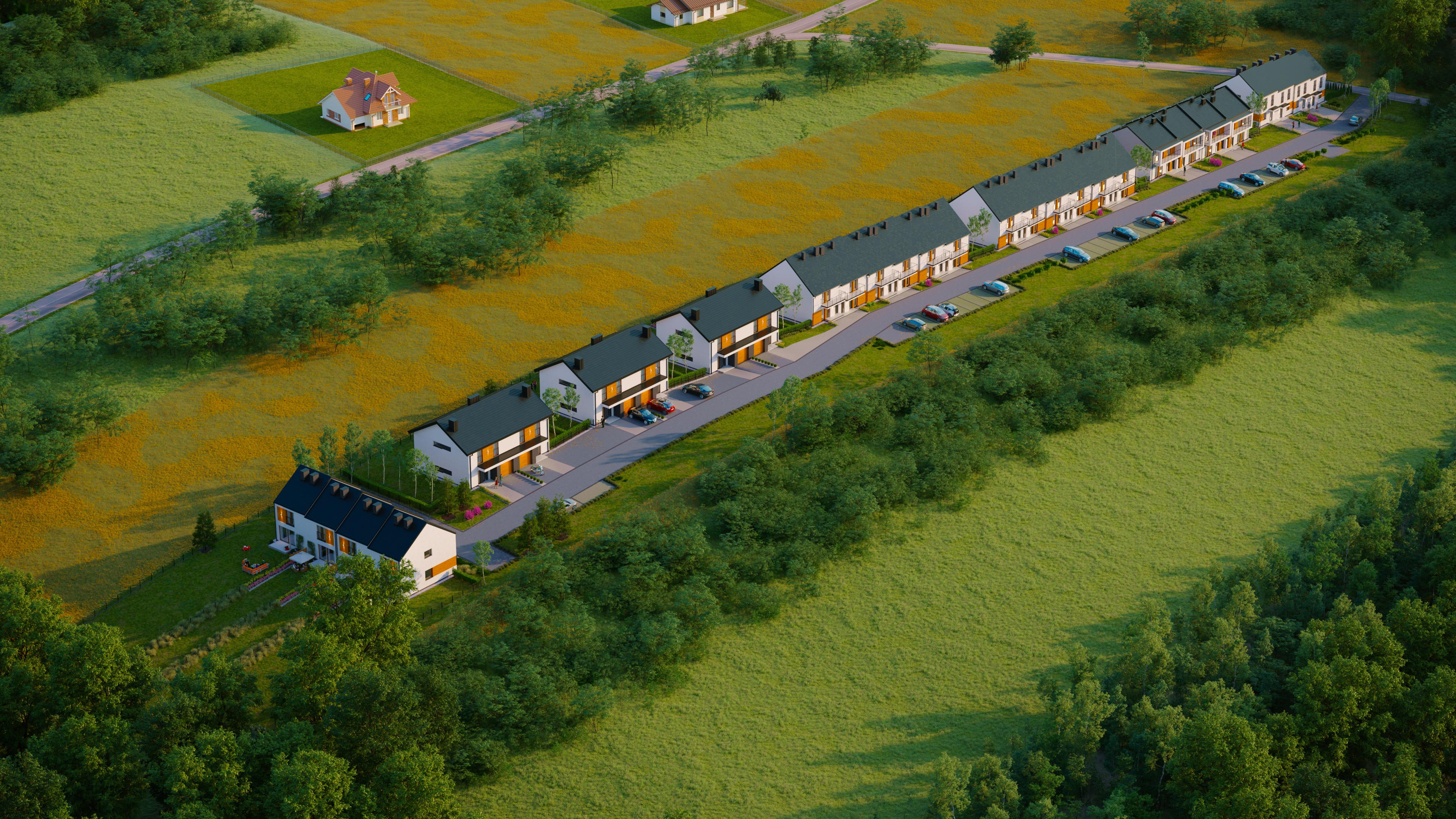
  • Scope – High-resolution exterior architectural rendering, camera-matched environmental integration, and master plan overview visualizations for a multi-family housing development.

  • Inputs – Architectural site plans (.dwg format), individual building elevation data, material schedules, and precise site-specific aerial drone photography for panoramic backdrop matching.

  • Terrain and Elevation Alignment – Reconstructed the physical slope geometry using topographic survey data to ensure the multi-family structures interact naturally with the hillside elevation layout.

  • Backdrop Camera Matching – Implemented high-precision camera calibration matching the focal length, height, and coordinates of real-world aerial plates, ensuring the view of Kraków is mathematically accurate from specific unit vantage points.

  • PBR Material Calibration – Formulated advanced material networks for modern facade plaster, textured composite panels, and low-iron architectural glazing to manage realistic light reflection and absorption.

  • Exterior Light Transport – Engineered a golden-hour daylight system to cast elongated shadows that emphasize the architectural depth and stepped layout of the estate.

  • Botanical Asset Scattering – Deployed detailed regional plant species, private lawns, and green buffer zones to soften the transition between structural concrete and the surrounding natural landscape.

The Business Outcome

Transitioning the Magnolia Residences project into a calibrated 3D asset pipeline gave the developer a decisive market advantage in a competitive suburban sector. By visually proving the exact line of sight and structural spacing to prospective buyers, the sales team neutralized major objections regarding spatial density and view obstruction. These production-ready digital twins accelerated the pre-sales cycle by 45%, reducing the developer reliance on expensive bridge financing and optimizing cash flow from the earliest phases of the investment.

Project FAQ

How do you guarantee that the view of the Kraków skyline in the renders matches the real-world perspective?

We achieve total geographical accuracy by using a technical process called camera matching. We import real-world aerial drone photography taken directly from the coordinates and specific heights of the planned apartment balconies. By alignment of the virtual cameras with the exact focal length and GPS data of the physical photo sessions, the rendering engine displays the true, unmanipulated view that future residents will experience from their windows.

Why is accurate terrain and slope modeling critical for multi-family housing visualizations?

Building on sloped or hillside terrain introduces spatial ambiguity for off-plan buyers, who often worry about building blockages, retaining walls, or awkward walkway angles. We rebuild the entire hillside layout using physical topographic surveys. This gives the developer a clear marketing asset that proves how each building is stepped into the landscape, ensuring that lower units do not obstruct the views of the upper residences.

Can these residential architectural renders be used for large-scale outdoor billboards and banners?

Yes, all building geometries and environmental layers are constructed using clean, high-density polygonal meshes and high-resolution PBR textures. This technical foundation allows the final images to be rendered out at ultra-high resolutions, ensuring crisp lines and zero pixelation when scaled up for construction site banners, roadside billboards, or high-end print brochures.

What technical files does our development team need to provide to initiate this project?

To ensure complete structural and spatial precision, we integrate directly with your design data. We require the standard 2D site master plans, individual unit floor plans, and building elevations in DWG or vector PDF formats. Additionally, providing your exterior material specification sheets, paint codes, and any site photography allows us to build an identical digital twin of your investment.

Ready to Accelerate Your Commercial Pre-Sales?

From architectural blueprints to high-fidelity CGI and immersive interactive virtual tours. We engineer visual assets that streamline investor approval loops, maximize property value, and drive conversions.

Discuss Your Project